Links To Early Circa 1790s Surveyor Field Notes For
Lots In The Military Tract Of Central New York Townships
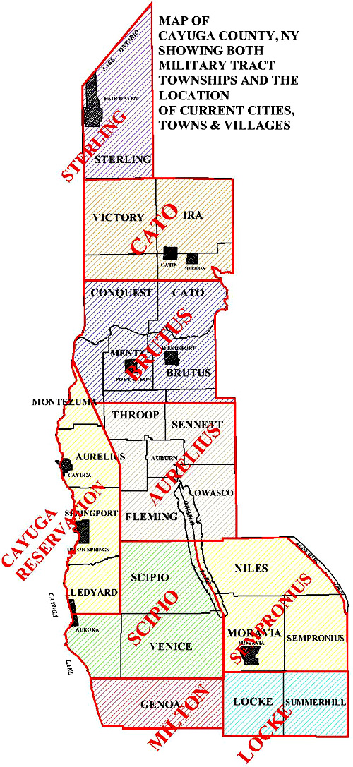
Within The Current Boundaries Of Cayuga County, NY
|
|
Original copies of the surveyor field notes cited above reside within the collections of the NY State Archives
THANKS to the folks at the 'History Center Room' of Seymour Public Library in Auburn NY
for obtaining the above linked records from the NY-State Archives and use of their microfilm scanner. |
 |
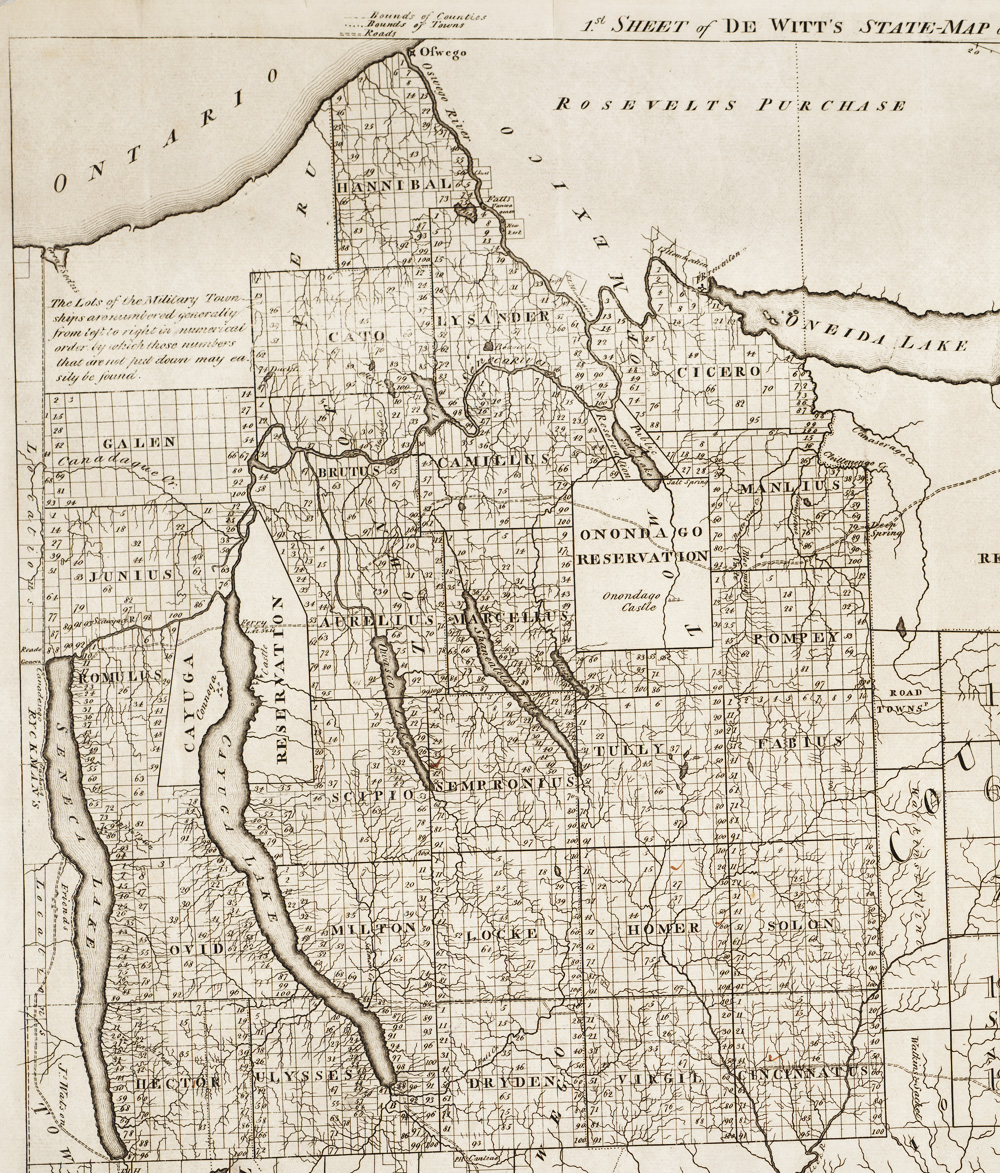
| View Military Tract Surveyor Field Notes For Lots In Township #5 CAMILLUS (Onondaga County NY) (23MB) || Historical summary about the Cayuga County NY portion of the Military Tract Of Central New York || Circa 1790s township lot MAPS for 'Military Tract Townships || Cayuga County NY TIMELINE CHART For Merges & Subdivisions Of Military Tract Townships Into Towns & Villages || Chart showing the relationship between the 8 original Military Tract Townships of circa 1789/1790 and current towns of Cayuga County NY || |
|
 |
|
| The above research was compiled in circa 2026 by Bernie Corcoran and is intended as a tool for personal genealogy and local history research. |
| Visit The 'Cayuga County-NYGenWeb-Project' Home-Page |